Pretty
Mary Lake house to Wile Rd Eastlink Tower
Base 44.4669N -65.153W, Antenna Height 14 meters, tree height 20 meters
Mobile 44.44663N -65.11312W, height 6.5 meters, tree height none for at
least 100 meters and then 10 meters
This link was of particular interest as Canopy 900 equipment deployed from the 30m tower at Wile Road was unable to make a reliable link. With the TVWS equipment we are getting a SNR of 17-20dBm from 6.5 meters, higher gain sector and yagi antennas are available that would yield an another 3dBm of link margin and if our simulations using Radio Mobile software are accurate increasing the antenna height to the same level as the Canopy antennas would yield an additional 13dBm of link margin for a total increase of 16dBm and a SNR of 36-39dBm.
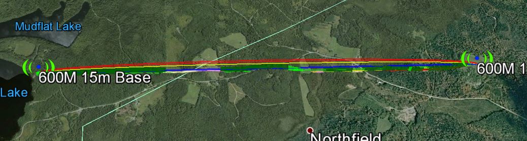
The link according to Google Earth link distance 3.88km elevation and foliage below.
KML File that opens in Google Earth is available for those wishing to take a detailed look at the terrain and vegetation
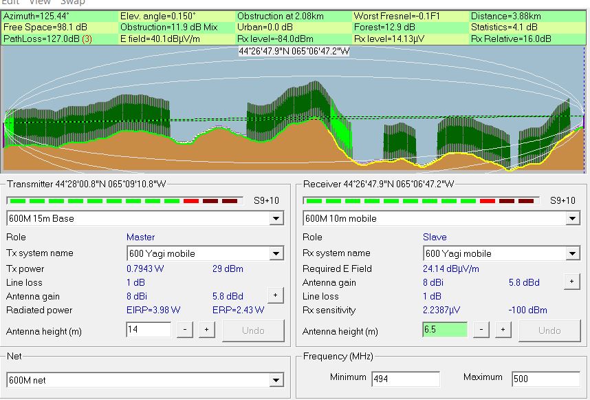
Radio Mobile simulated link data using assumed tree height of
20 meters and density of 130
This setting can be found under options- elevation data
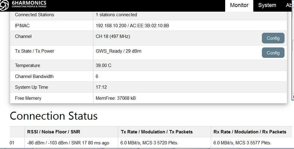
Measured results from Base Station status page
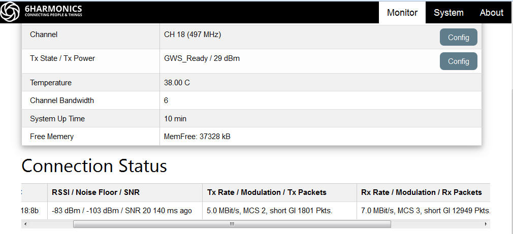
Measured results from Mobile CPE Status page
![]()
File Transfer
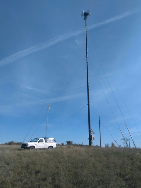
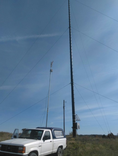
Our Mobile test antenna at only 6.5m due to the high wind versus 30m of the Canopy 900 system, the lense of the camera is responsible for the masts not appearing vertical.
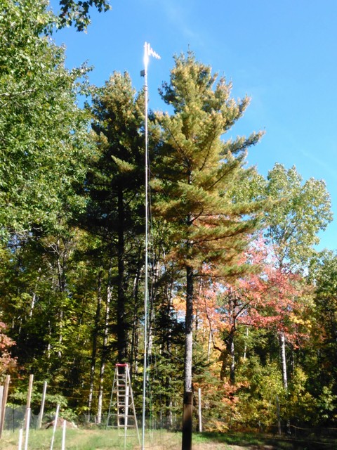
Base Station antenna at 14m behind 20m pine trees.
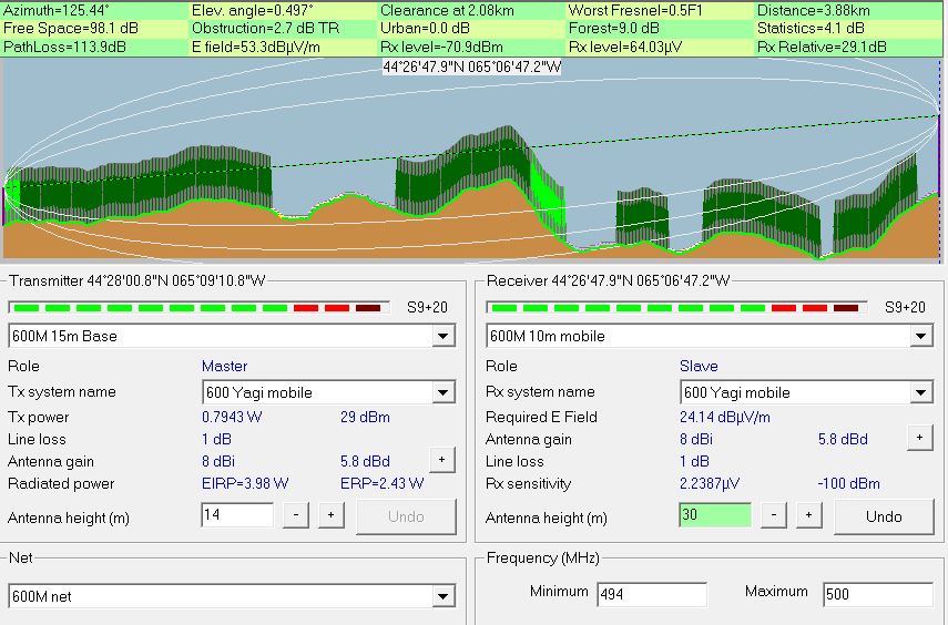
Simulate link assuming TVWS antennas at Wile road are all at the same 30m height as the Canopy antennas.