North Queens TV White Space Trials
Terrain and Vegetation

|
|
North Queens TV White Space Trials Terrain and Vegetation |
|
|
|
||||
|
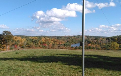
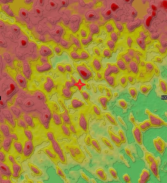
The map below illustrates the problem, our 2nd test site is on a low hill 20m above the surrounding terrain within a 5km radius we can count more than 80 hills of the same height or higher. Nearly all the population is located on lower land between the hills making them hard to reach
The vegetation is a mix of evergreen and deciduous trees averaging 20m in height with occasional higher areas. The type and height of the vegetation can make a significant difference to the signal path so we have gone to some length to show this on each test report, we have included Google Earth files making it possible to visualize the signal path in great detail. |
||||