Test 3
Pretty Mary Lake house to Northfield Rd
Base 44.4669N -65.153W, Antenna Height 14 meters, tree height 20 meters
Mobile 44.4452N -65.1914W, Antenna height 9 meters, tree height 10
meters
This link is interesting because it illustrates how a link is possible despite there being a heavily treed small hill in the signal path, it is one of the major advantages of the propagation characteristics offered by the lower frequencies that TVWS employs.
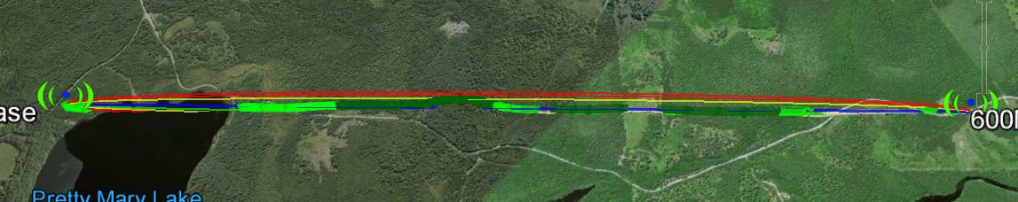
The link according to Google Earth link distance 3.88km elevation and foliage below.
KML File that opens in Google Earth is available for those wishing to take a detailed look at the terrain and vegetation
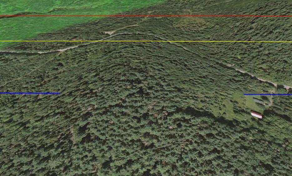
Direct line of sight signal path (blue line) is 12.6m below the hill surface which is in turned covered with 20m trees, the is simply no way you can make a link like this work using multi Giga Hertz equipment.
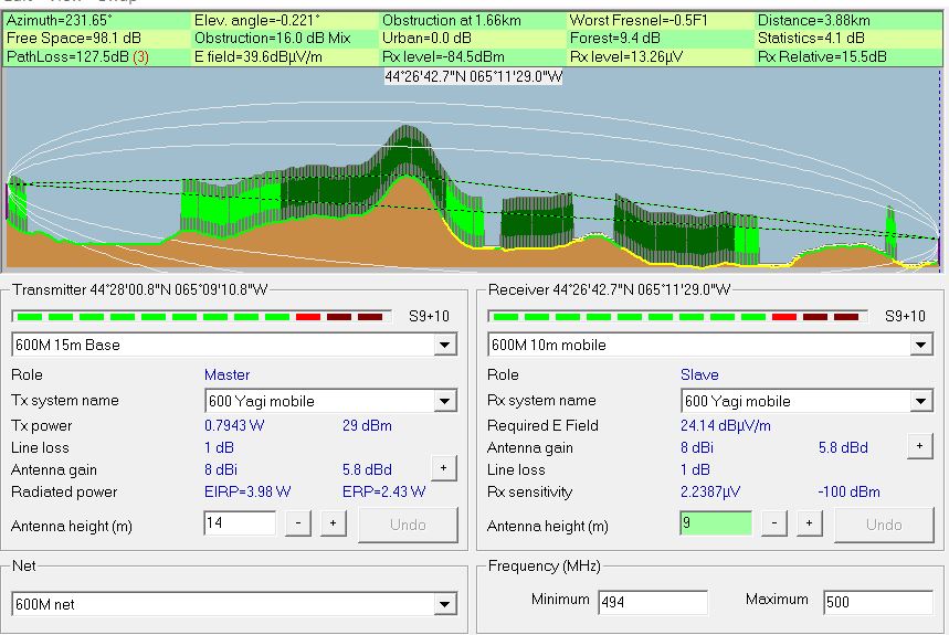
Radio Mobile simulated link data using assumed tree height of
20 meters and density of 130
This setting can be found under options- elevation data.
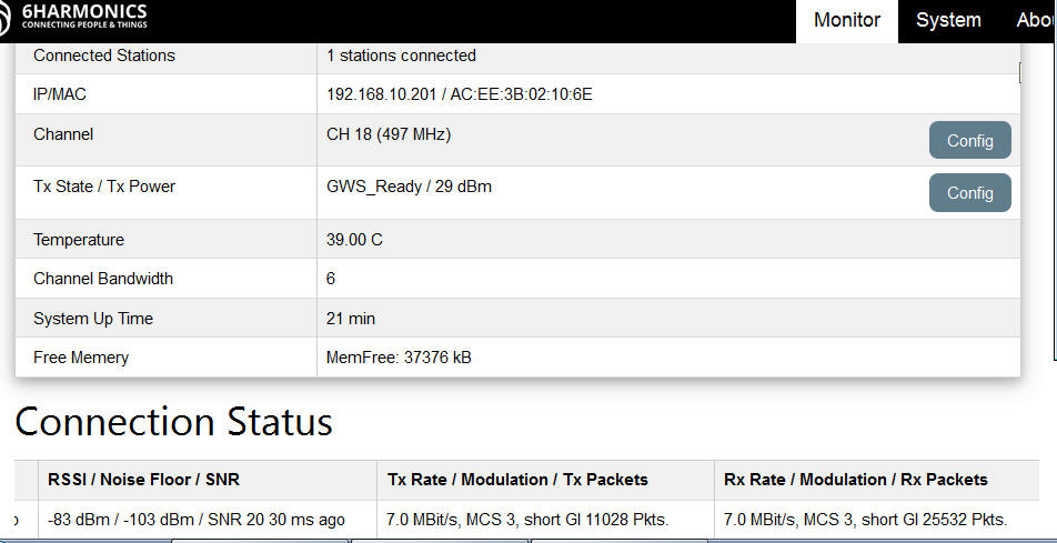
Measured results from Mobile CPE Status page
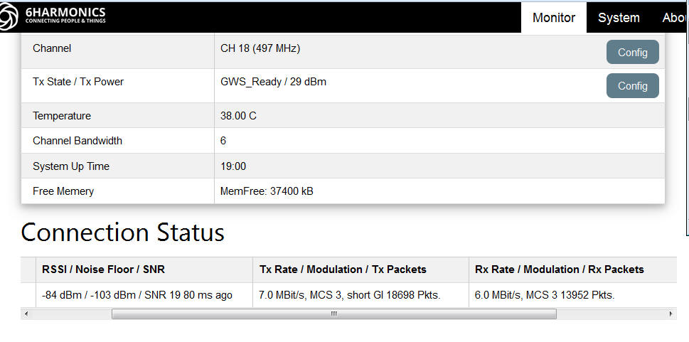
Measured results from Base Station status page
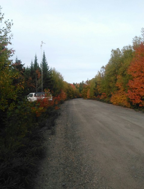
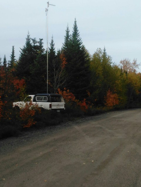
Mobile test antenna at 9m surrounding trees 10-12 meters, tree height along signal path varies between 10m and 25m
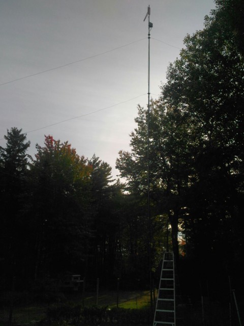
Base Station antenna, just a few 25m pine trees in the way and then another 700m in the clear over the lake before the next obstruction.