Test 4
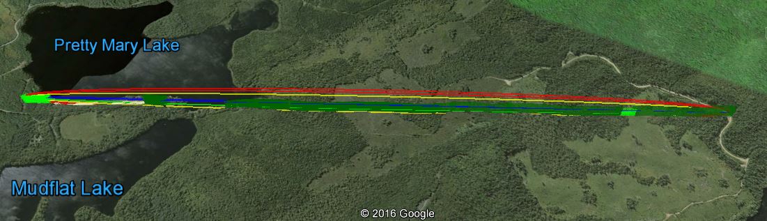
Pretty Mary Lake house to Woods Rd
Base 44.4669N -65.153W, Antenna Height 14 meters, tree height 20 meters
Mobile 44.4864N -65.1675W, Antenna height 6.5 meters, tree height 8
meters
The is a significant difference between the simulated performance and real world performance which we believe can at least partially be explained by errors in the foliage data used by the simulation software.
The link according to Google Earth link distance 2.45km elevation and foliage below.
KML File that opens in Google Earth is available for those wishing to take a detailed look at the terrain and vegetation
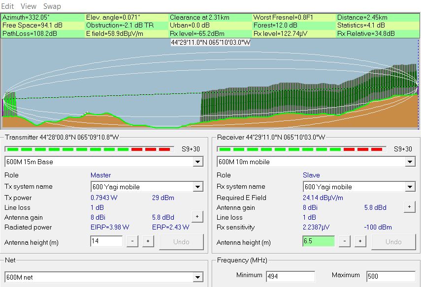
Radio Mobile simulated link data using assumed tree height of
20 meters and density of 130
This setting can be found under options- elevation data.
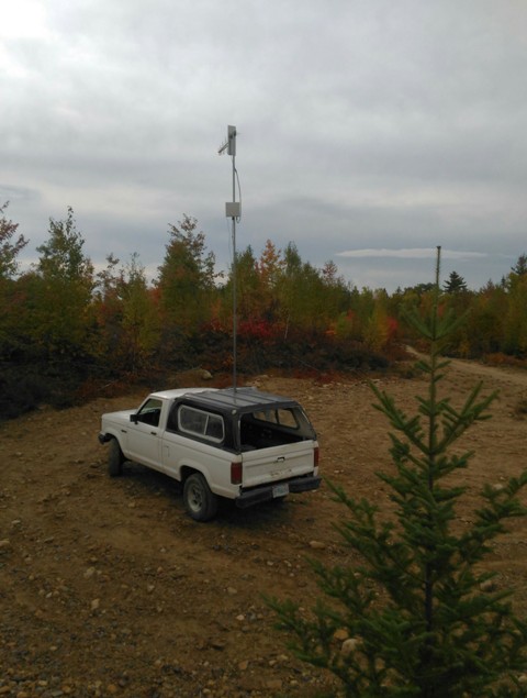
The source of foliage data used by Radio mobile has some errors, there is more tree cover at the Pretty Mary Lake end to the left of the link and less to the right due to recent logging activity (7 years ago), as can seen on Google Earth and of the picture of the mobile test unit at the test site below.
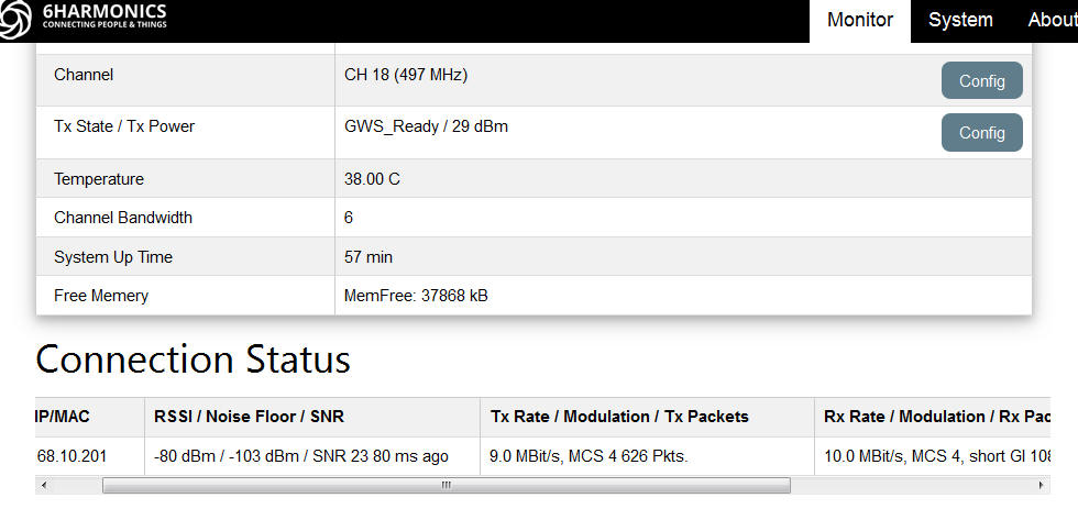
Measured results from Base Station status page
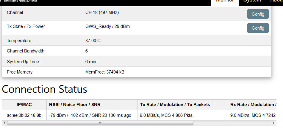
Measured results from Mobile CPE Status page