Pretty Mary Lake house to Northfield Rd
Base 44.4669N -65.153W, Antenna Height 14 meters, tree height 20 meters
Mobile 44.455N -65.1659W, Antenna height 6.5 meters, tree height 10-15 meters
This is a straight forward link through just over a l km of forest, given our previous experience with signal lose in the forest we were pleased that signal levels came in so close to the predicted levels (we so far haven't adjusted the correction for tree density). We think one of the major reason as can be seen in the pictures of the antennas is that we had a reasonable amount of free space around the antennas at each end of the link, enabling them to function as designed, unlike in some other tests. Second although the average tree height is ~20m it is lower at the mobile on right side of the link (Cross Road) and completely clear for a few hundred feet before the antenna.
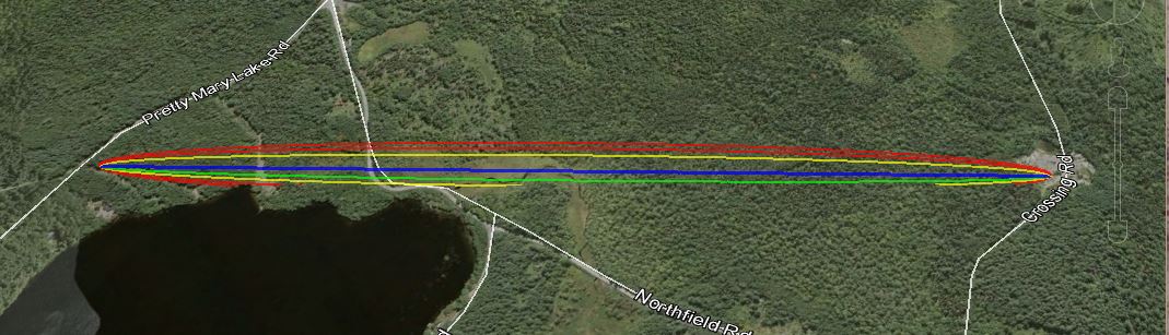
The link according to Google Earth link distance 1.67 km elevation and foliage below.
KML File that opens in Google Earth is available for those wishing to take a detailed look at the terrain and vegetation
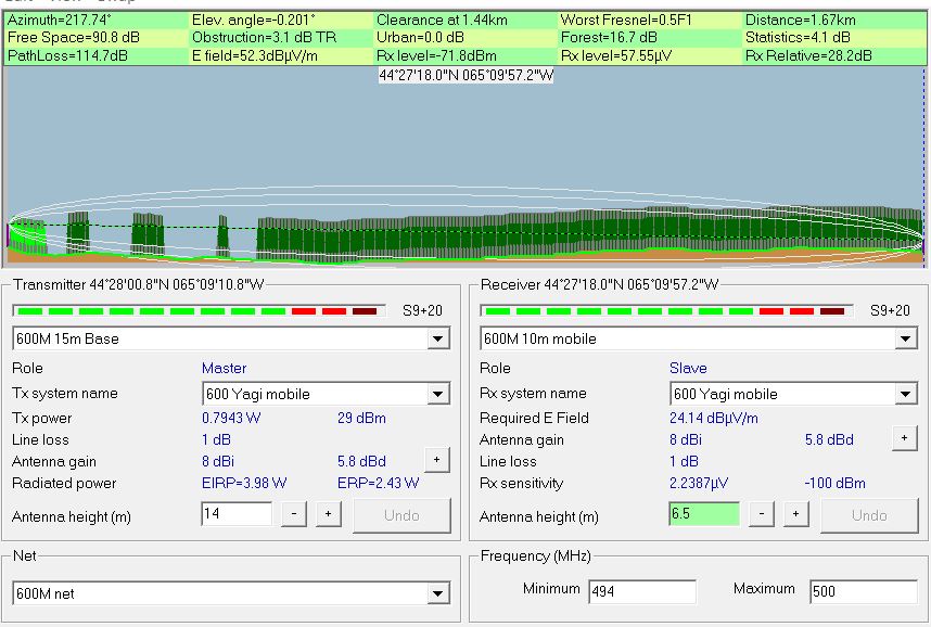
Radio Mobile simulated link data using assumed tree height of
20 meters and density of 130
This setting can be found under options- elevation data.
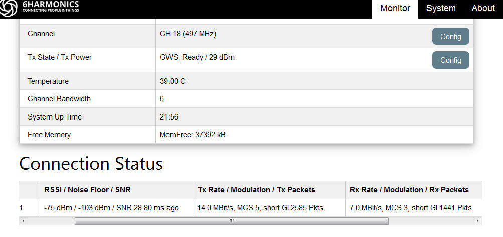
Measured results from Base Station status page
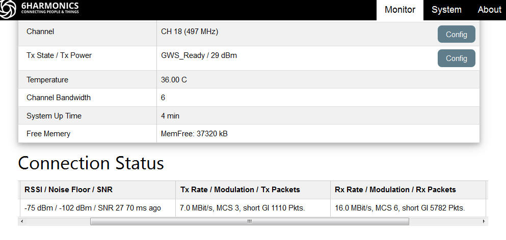
Measured results from Mobile CPE Status page
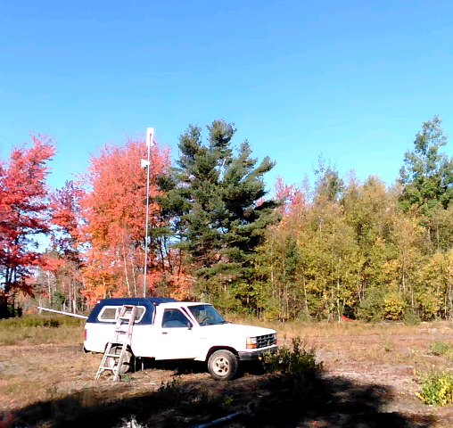
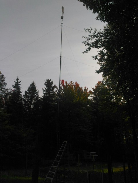
Mobile at a clearing in the forest and base station at the same location as in the previous 7 tests, with the antenna pointing in this direction the is approximately 100ft of free space before encountering trees.