Test site 2 to Broham Road
Base 44.37996N -65.0064W antenna height 14m, no trees within 200ft and then literally a couple of 20m evergreens in the signal path before escaping into free space
Mobile 44.348N -65.0443W, Antenna height 6.5 meters, no tree within 200ft and then deciduous trees of 15m
The kind of link we wish we could have all the time! and the reason we attempt to clearly show all signal paths although it does pass through a few hundred metres of heavy forest describing it as a 4.66km link through forest would in our view be misleading.
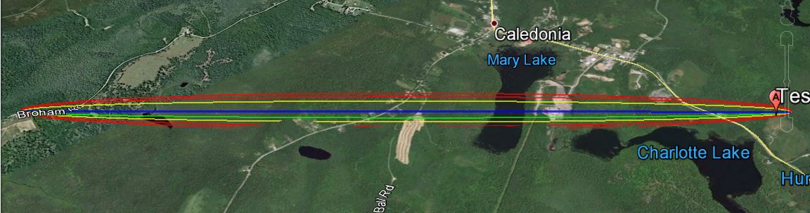
The link according to Google Earth link distance 4.66km elevation and foliage below.
KML File that opens in Google Earth is available for those wishing to take a detailed look at the terrain and vegetation
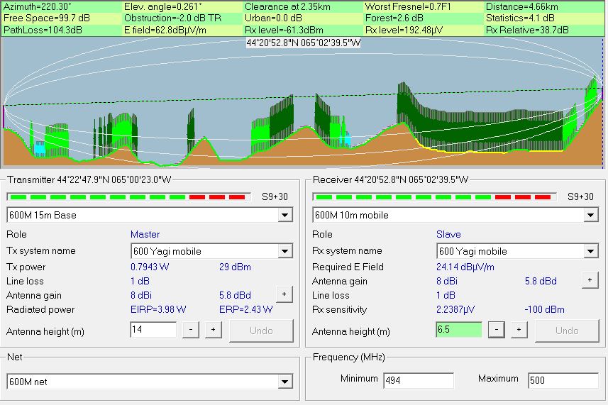
Radio Mobile simulated link data using assumed tree height of
20 meters and density of 130
This setting can be found under options- elevation data.
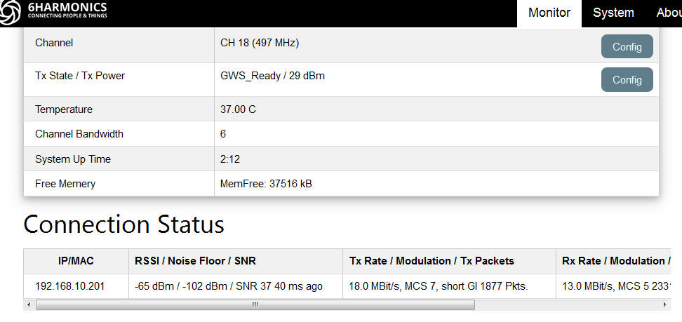
Measured results from Base Station status page
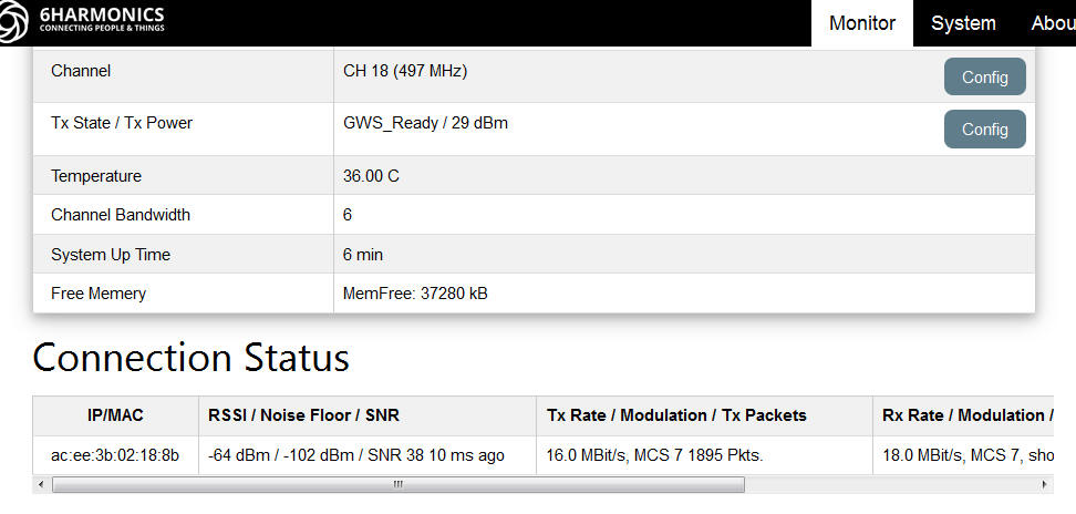
Measured results from Mobile CPE Status page
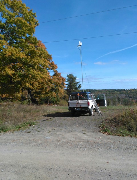
Mobile antenna signal path through a few trees before escaping into free space, a similar situation exists at the base station