Test 11
Test site 2 to Highway 8
Base 44.37996N -65.0064W antenna height 14m, no trees
Mobile 44.357915 -64.963330 antenna height 6.5m, 25m broadleaf trees within 50m
Another example of TVWS signals ability to establish a link despite a solid obstruction in the signal path and heavy tree cover around the client premises
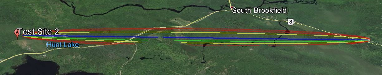
The link according to Google Earth link distance 4.21km elevation and foliage below.
KML File that opens in Google Earth is available for those wishing to take a detailed look at the terrain and vegetation
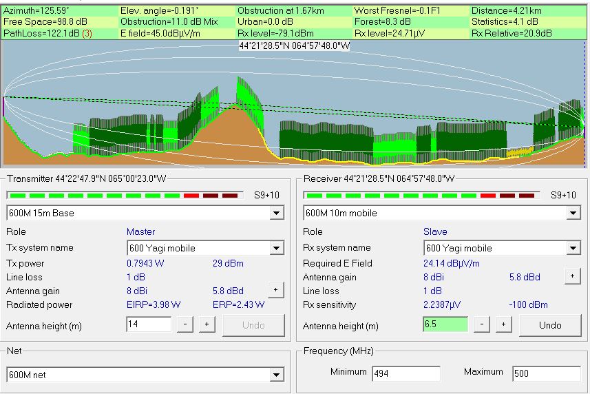
Radio Mobile simulated link data using assumed tree height of
20 meters and density of 130
This setting can be found under options- elevation data.
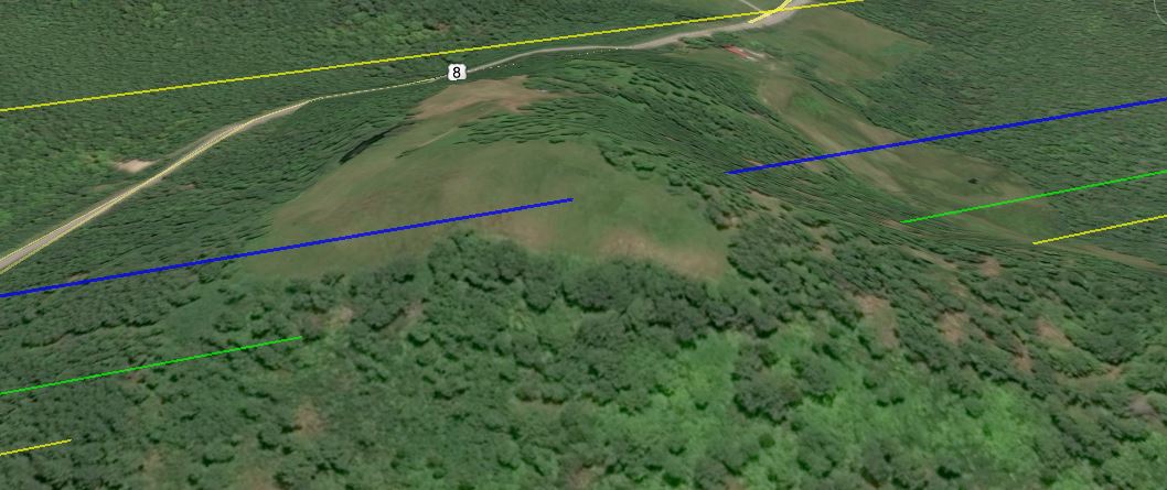
A closer look at the 2.74m obstruction 1.67km into the signal path, blue line is the direct line of sight between base and mobile.
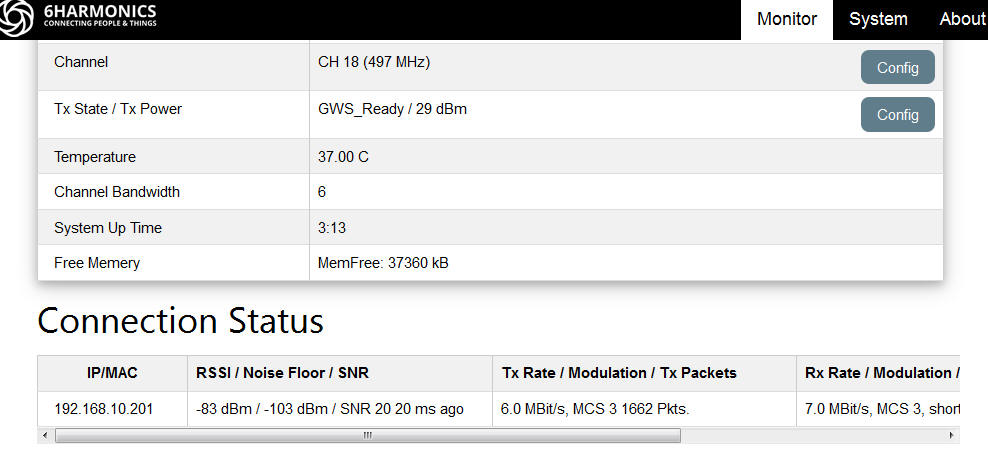
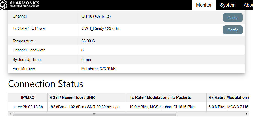
Measured results from Base Station status page.
The first tests were conducted in earlier October a second set of test were conducted a month later when most of the leafs had left the trees these resulted in an increase in signal strength of 7dbm
Measured results from Mobile CPE Status page.
The first tests were conducted in earlier October a second set of test were conducted a month later when most of the leafs had left the trees these resulted in an increase in signal strength of 5dbm
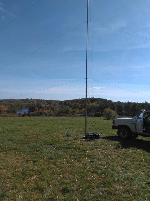
 Our mobile test antenna at 6.5m behind 25m trees at client premises. Also of note to the left of our truck is a utility pole with antenna mounted at ~15m that the local WISP requires to clear obstructions. TVWS has the potential to significantly reduce these deployments and associated expense.
|
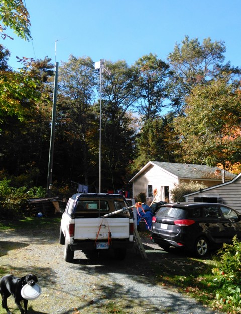
 Base Station antenna mast, our client is 2.5km on the other side of the hill immediately behind the mast.
|