Test 13
Test site 2 to Westfield Hall
Base 44.37996N -65.0064W antenna height 14m, no trees for 200ft and then a line of 20m trees 2 deep before clear space
Mobile 44.41582 -65.02461 antenna height 6.5m
A challenging test due to 2 hills at the client end including a solid obstruction plus the first case of horizontal diffraction around an obstruction that we have noted.
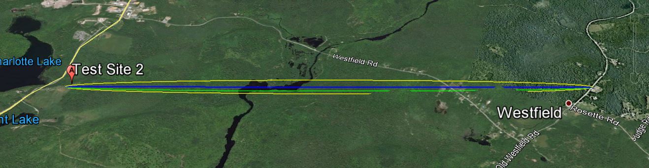
The link according to Google Earth link distance 4.24km elevation and foliage below.
KML File that opens in Google Earth is available for those wishing to take a detailed look at the terrain and vegetation
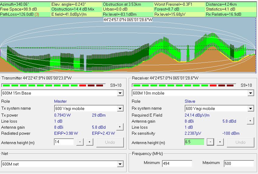
Radio Mobile simulated link data using assumed tree height of
20 meters and density of 130
This setting can be found under options- elevation data.
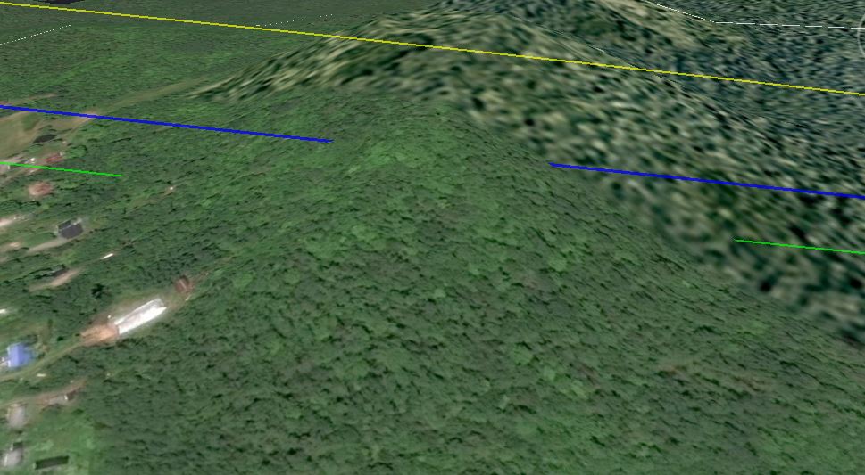
A closer look at the 5.6m obstruction 3.5km into the signal path, blue line is the direct line of sight between base and mobile.
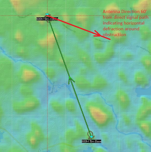
Antenna direction was 60' away from the direct line of sight indicating horizontal diffraction around obstacles. Pointing the antenna directly at the line of sight to the base resulted in a drop of 3dBm in signal strength
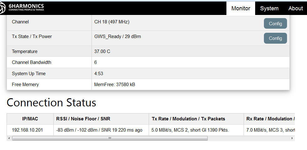
Measured results from Base Station status page.
The first tests were conducted in earlier October a second set of test were conducted a month later when most of the leafs had left the trees these resulted in an increase in signal strength of 5dbm
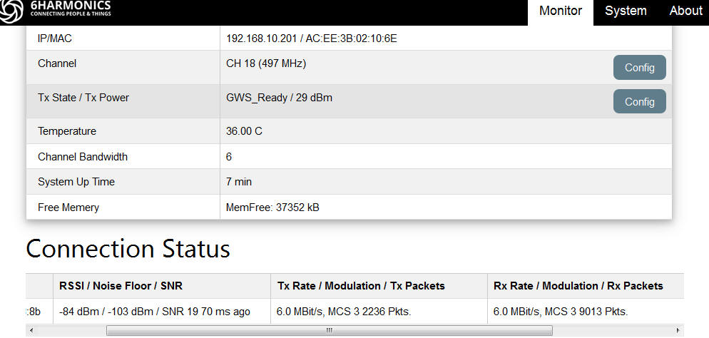
Measured results from Mobile CPE Status page
The first tests were conducted in earlier October a second set of test were conducted a month later when most of the leafs had left the trees these resulted in an increase in signal strength of 6dbm
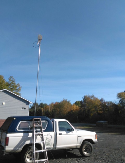 Mobile antenna pointing 60' away from the direct line of sight
|
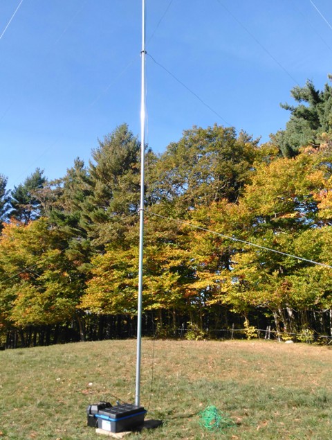 Base station signal path has to pass through this row of fortunatly only 2 -3 20m trees before the hill falls away and the signal enters free space. |