Test 19
Test site 2 to Westfield Church
Base 44.37996N -64.9701W antenna height 14m 8dBi yagi, clear for 150ft and then a few trees
Mobile 44.4117N -65.0152W antenna height 6.5m 8dBi yagi, 15m deciduous trees.
A my now fairly routine 3.6km link 1/2 through forest
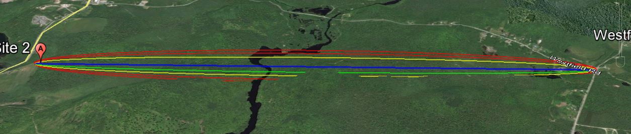
The link according to Google Earth link distance 3.6km, elevation and foliage below.
KML File that opens in Google Earth is available for those wishing to take a detailed look at the terrain and vegetation
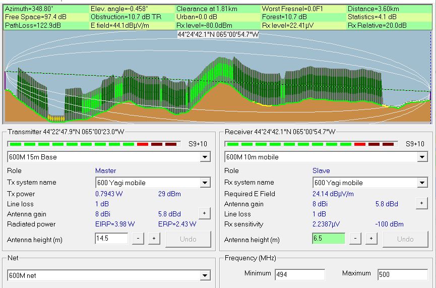
Radio Mobile simulated link data using assumed tree height of
20 meters and density of 130
This setting can be found under options- elevation data.
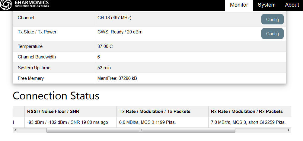
Measured results from Base Station status page
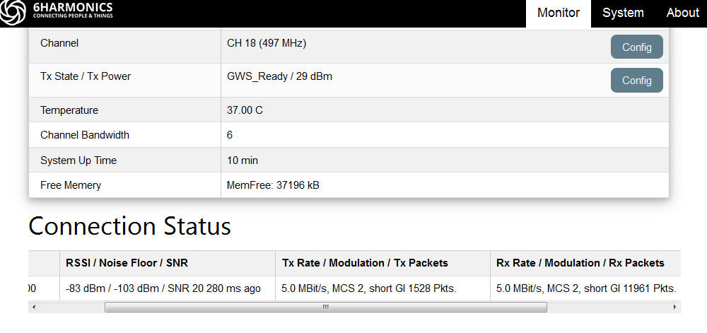
Measured results from Mobile CPE Status page
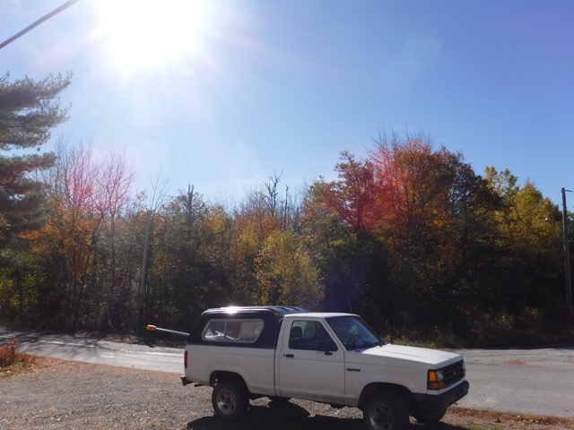 Signal path over the truck into 15-20m vegetation |
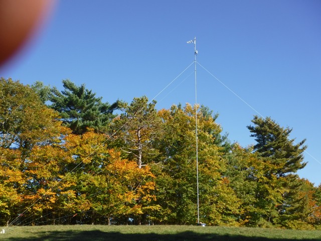 Our signal path is through this 2-3 deep row of trees and then into free space. |