Coverage

|
|
North Queens TV White Space Trial Coverage
|
|
|
|
||||||||||
|
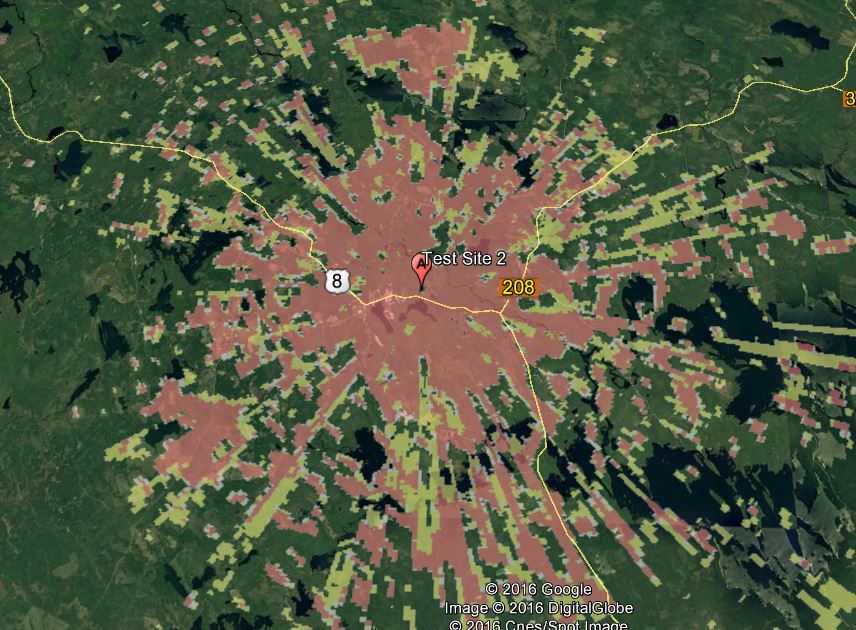
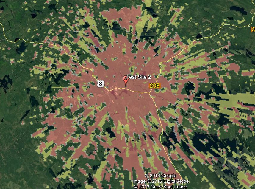
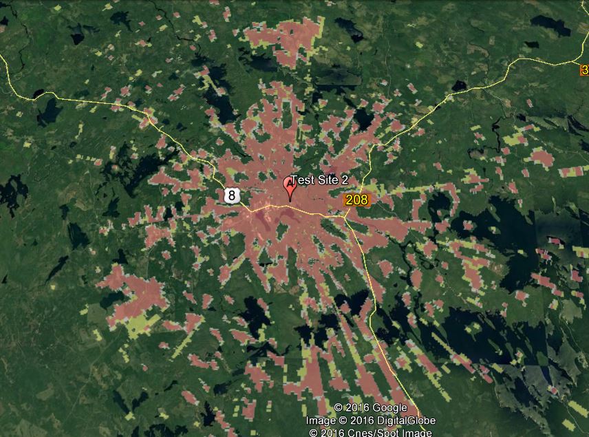
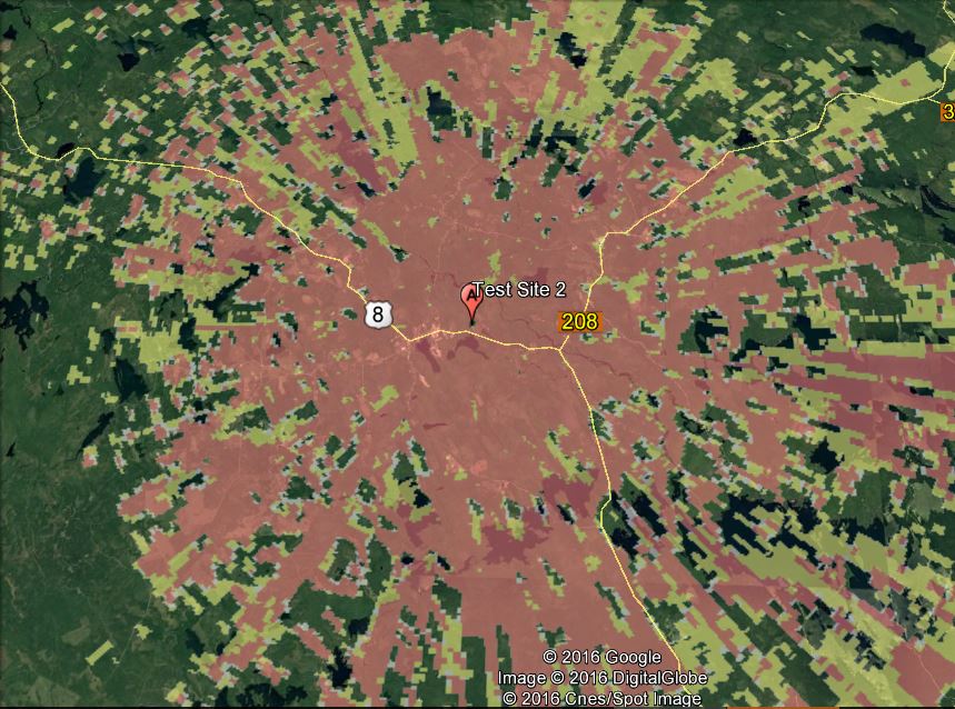
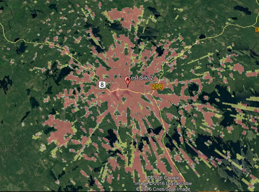
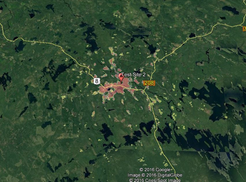
The maps below show our expected coverage using various unlicensed or lightly regulated bands and different antenna gains, from our 2nd test site but assuming we have our base station antennas at a height of 30m (the legal maximum) instead of 14m employed in the tests, the subscriber antennas are at a height of 9m and a maximum tree height of 25m. The area in red has a signal level great that -80dBm and the area in yellow greater than -85dBm.
The maps clearly show the increase in coverage available in our area and together with the considerable available spectrum hold a great potential to ease our internet problems.
Since these maps cover a large area and are not easy to see on the average computer screen we have included a KMZ file that can be viewed in great detail in Google Earth If you have Google earth installed in your computer download the file, double click on it and it should open in Google Earth, temporary places on the left hand side of the screen, select a button to see the coverage with different bands and antennas.
|
||||||||||
|
In constructing these maps we have used extensive data from our TVWS trials to correct the input assumptions and have a high level of confidence with the results, for 900 Mhz our data is sparse so these prediction could be less accurate and we have none for the 3.65Ghz band so have used program defaults which have proven optimistic in other bands. In the future we hope to have more data available for both TVWS and 900Mhz using antennas at 30 meters.
In all case we have assumed the transmit power has been adjusted to give the maximum legal power (36dBm) with a particular antenna so the coverage is limited by the subscriber modules ability to hear the base station.
|
||||||||||